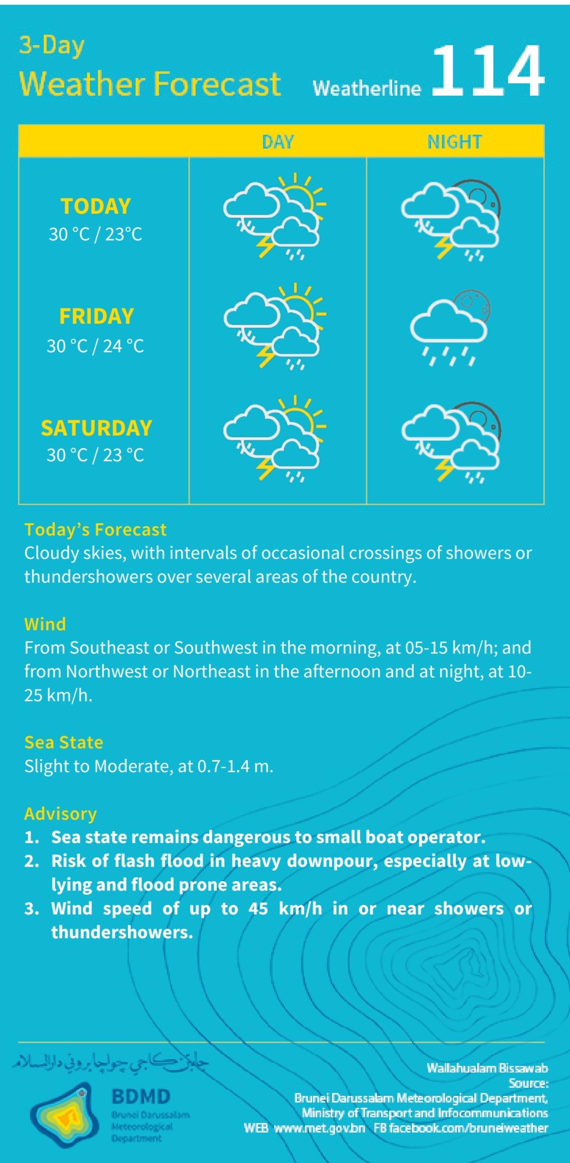
(Bandar Seri Begawan, 14th) The Brunei Meteorological Department has issued the latest three-day weather forecast, predicting that many areas nationwide will continue to experience cloudy weather, accompanied by intermittent showers or thunderstorms.
The forecast shows that daytime temperatures on tomorrow, Friday, and Saturday will generally be around 30°C, with minimum nighttime temperatures between 23 to 24°C. There is a possibility of thunderstorms both during the day and at night. According to the Meteorological Department, today's weather is mainly cloudy, with several areas across the country experiencing showers or thunderstorms. In terms of wind direction, winds in the early morning will mainly come from the southeast or southwest at speeds of 5 to 15 km/h, shifting to northwest or northeast in the afternoon and at night, and increasing to 10 to 25 km/h. In localized areas during showers or thunderstorms, wind speeds may reach up to 45 km/h. As for sea conditions, the sea will range from slight to moderate in the coming days, with wave heights around 0.7 to 1.4 meters. Operating small boats remains hazardous. The Meteorological Department has also issued a warning that heavy rainfall may cause flash floods, especially in low-lying and flood-prone areas, and reminds the public, maritime operators, and relevant departments to closely monitor the latest weather advisories and take precautionary measures.
The forecast shows that daytime temperatures on tomorrow, Friday, and Saturday will generally be around 30°C, with minimum nighttime temperatures between 23 to 24°C. There is a possibility of thunderstorms both during the day and at night. According to the Meteorological Department, today's weather is mainly cloudy, with several areas across the country experiencing showers or thunderstorms. In terms of wind direction, winds in the early morning will mainly come from the southeast or southwest at speeds of 5 to 15 km/h, shifting to northwest or northeast in the afternoon and at night, and increasing to 10 to 25 km/h. In localized areas during showers or thunderstorms, wind speeds may reach up to 45 km/h. As for sea conditions, the sea will range from slight to moderate in the coming days, with wave heights around 0.7 to 1.4 meters. Operating small boats remains hazardous. The Meteorological Department has also issued a warning that heavy rainfall may cause flash floods, especially in low-lying and flood-prone areas, and reminds the public, maritime operators, and relevant departments to closely monitor the latest weather advisories and take precautionary measures.