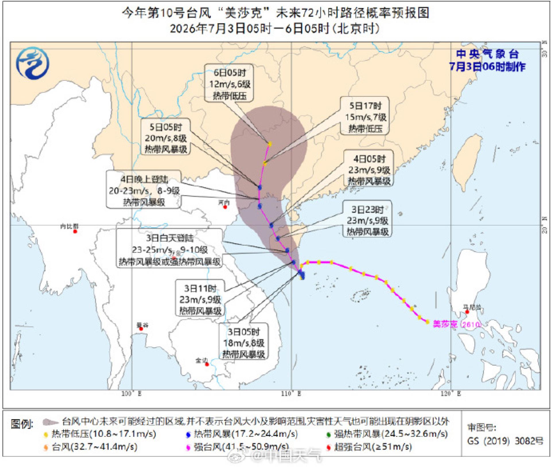
According to official Chinese reports, the 10th typhoon of the year, 'Maysak', has formed and is expected to make landfall along the coast of Hainan on the 3rd. This will be the first typhoon to land in China this year.
According to China Weather Network and the Hainan Meteorological Bureau, the tropical depression in the South China Sea strengthened into this year’s 10th typhoon “Maysak” (tropical storm level) in the early hours of July 3.
At 5 a.m., the center of “Maysak” was located about 155 kilometers southeast of Lingshui County, Hainan Province, over the central-western area of the South China Sea. The maximum wind speed near its center was at force 8 (18 meters per second).
“Maysak” is expected to move northwestward at a speed of 10 to 15 kilometers per hour, with further strengthening anticipated. It will make landfall along the coast between Sanya and Qionghai in Hainan during the day on the 3rd (23 to 25 meters per second, force 9 to 10, tropical storm or severe tropical storm level), cross Hainan Island, and enter the Beibu Gulf, then make landfall again on the night of the 4th near the coastal border of Guangxi and northern Vietnam (20 to 23 meters per second, force 8 to 9, tropical storm level), after which its strength will gradually decrease.
The Hainan Meteorological Bureau raised the typhoon alert from level 4 to level 3 at 6:30 a.m. on the 3rd. China’s typhoon warning signals are divided into four levels, represented by blue, yellow, orange and red colors, corresponding to general, relatively severe, severe, and particularly severe categories respectively.