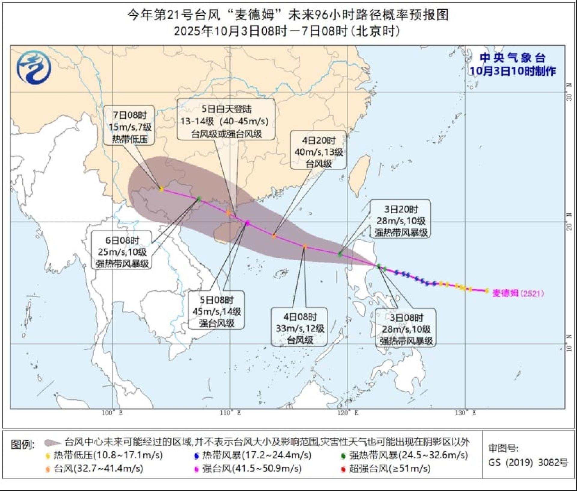
On the morning of the 3rd, at 10 a.m., the China Central Meteorological Observatory issued the latest typhoon bulletin. It is estimated that Typhoon Matmo will pass through the Philippines’ Luzon Island during the day, then approach the coastal area from western Guangdong to the eastern part of Hainan Island, and its intensity is gradually strengthening. The typhoon is expected to make landfall during the day on the 5th.
According to the latest typhoon bulletin from the China Central Meteorological Observatory at 10 a.m. on the 3rd, the center of Matmo was located over the offshore area of eastern Luzon Island, Philippines at 8 a.m. that morning, with maximum winds near the center at Force 10 (28 meters per second) and a minimum central pressure of about 982 hPa.
It is estimated that Matmo will move northwestward at a speed of about 30 kilometers per hour, cross the Philippines’ Luzon Island during the day on the 3rd, then enter the eastern part of the South China Sea, and gradually approach the coastal area between western Guangdong and eastern Hainan Island, with intensity continuously increasing.
It is predicted that Matmo could reach the strength of a severe typhoon (Force 14 to 15, 42 to 48 meters per second). It is expected to make landfall along the aforementioned coastal areas during the day on the 5th, after which its intensity will gradually weaken; strong wind bulletins continue to be issued, and winds of Force 10 to 12 may occur in nearby sea areas as Matmo's center passes by.